- Screen Colours:
- Normal
- Black & Yellow
 Worlingworth is a parish of some 2,400 acres situated approximately 6 miles North West of Framlingham and 6 miles north east of Debenham. It has a population of about 740 (SCC figures in 2005).
The community centre offers facilities and has a large playing field which hosts football and cricket games for the local teams.
The village has a thriving primary school, a well supported church, an active Local History group, a social club, a Women's Institute, Community Centre committee, Social Club and various sports groups.
In addition, there are many social activities throughout the year including a summer fete, a fireworks evening, and a safari supper.
 The village topography is typical of a Suffolk parish, a long "street" with isolated groups of dwellings (perhaps a farm and one or two labourer's cottages) and the occasional narrow side road leading off to a neighbouring parish. The church and The Swan form the centres of the two main settlement clusters and visual evidence of the ancient village green - the former commonland - exists today with the preservation of Great Green on Shop Street. Worlingworth straggles along an unclassified road which roughly heads south-east to north-west from the direction of Framlingham to Eye.
The area to the south and east used to be known as the "Suffolk Woodland" - centuries ago, the land was heavily wooded - many Suffolk oaks were used to build the Royal Navy ships that served the nation from the time of Henry VIII to Nelson.
The major employer in the village is L.E. Tuckwell Ltd, who as well as being a land owner is a major agricultural supplier in the area.
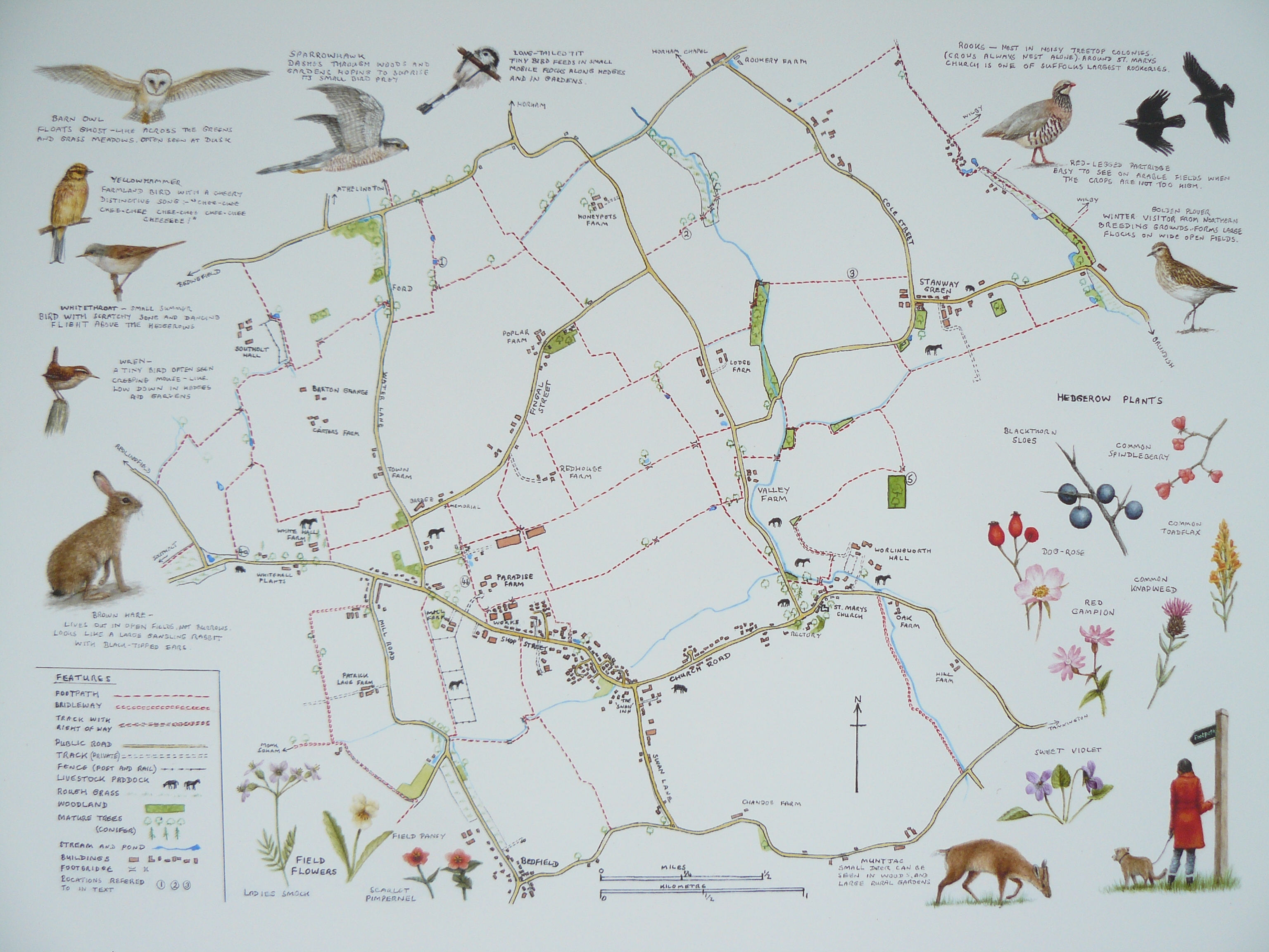
 Wildlife is plentiful in the area and can be enjoyed by following one of many paths in the Worlingworth Wayfinder. This was produced in 2008 to mark the completion of the Worlingworth footpath improvement scheme. This provides for 17 miles of easy to follow walks through gently rolling, open landscape of arable fields, grazing meadows and ancient greens.
For a copy of the Worlingworth Wayfinder, click on the link.
If, when walking our footpaths, you find a route either blocked or poorly maintained, please contact Suffolk County Council on 0845 606 6067.